Jack of all trades:
Archaeologist, Designer, Anthropologist, Cartographer, Historian
I'm a recent graduate of the University of Wisconsin–Madison, with a BS in Anthropology and History and a minor in Archaeology, but beyond that I'm a freelance graphic, web, and sometimes game designer with experience from cartography to worldbuilding and everything in between.
Portfolio
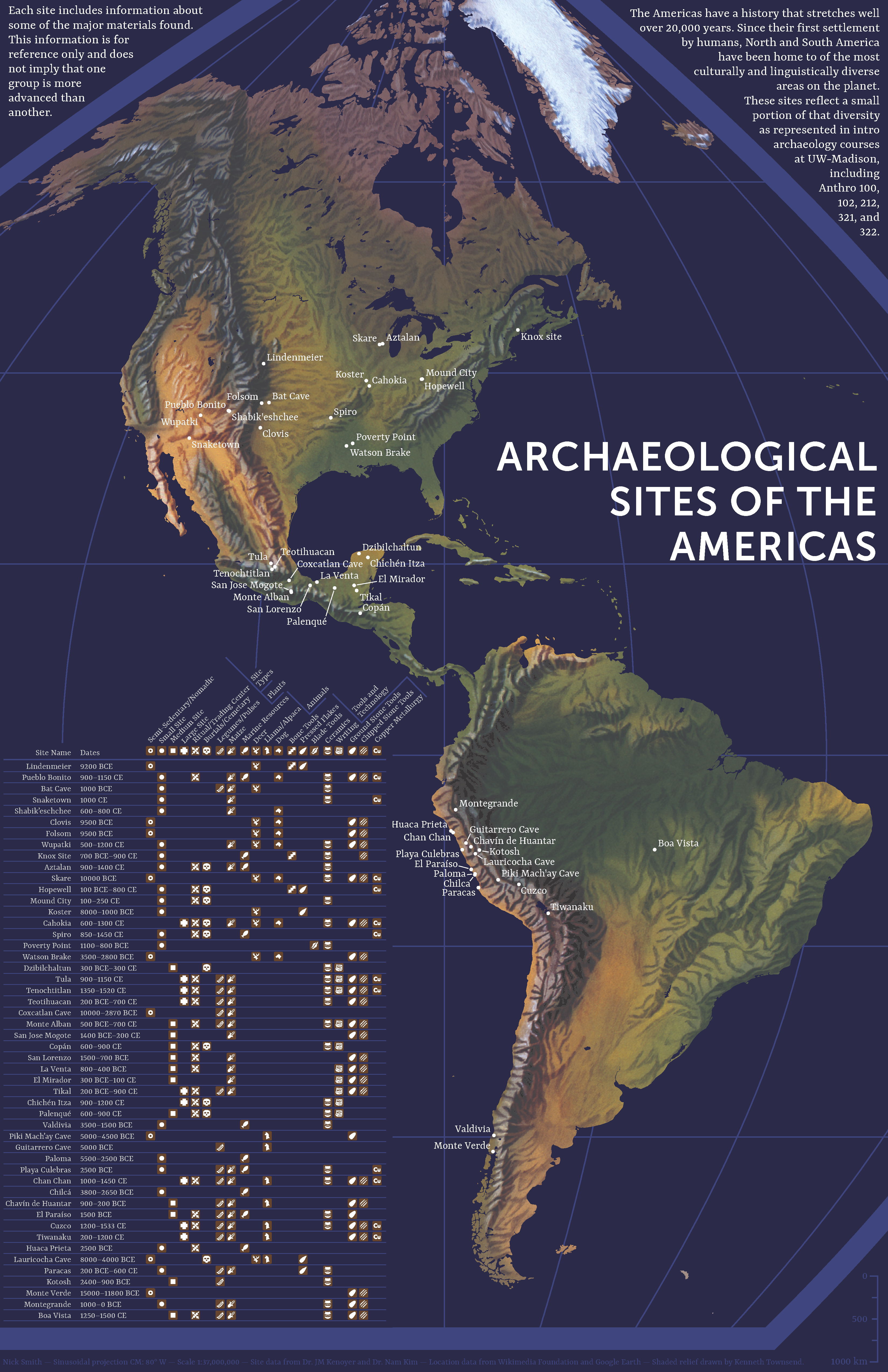
Archaeological Sites of the Americas
#Map #Archaeology
I completed this map for my final prject in Intro to Cartography at UW–Madison. I wanted to blend my love of archaeology with that of cartography while keeping a distinctive style.
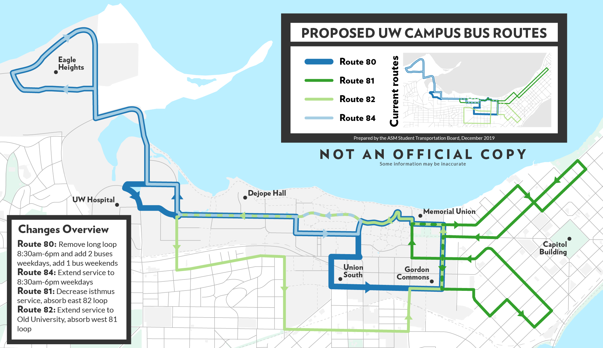
UW–Madison Proposed Campus Bus Routes
#Map #InTheWild #Community
I made this map for a student government committee I'm on, the Student Transportation Board, which oversees UW–Madison's campus bus program. We spent a year discussing these changes and now we're in the process of proposing them to the public! Fun fact: Wisconsin is the only state where university student governments are protected and required by law (Wisconsin State Statute 36.09(5)).
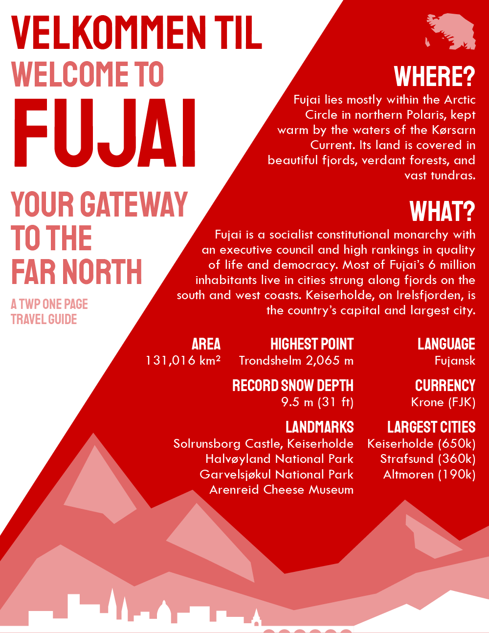
A One-Page Travel Guide to Fujai
#Graphic #NationStates
Back at it again with a full one-page travel guide to a fictional country. I was extremely pleased with how this turned out, and it's one of my favorite designs to this day.
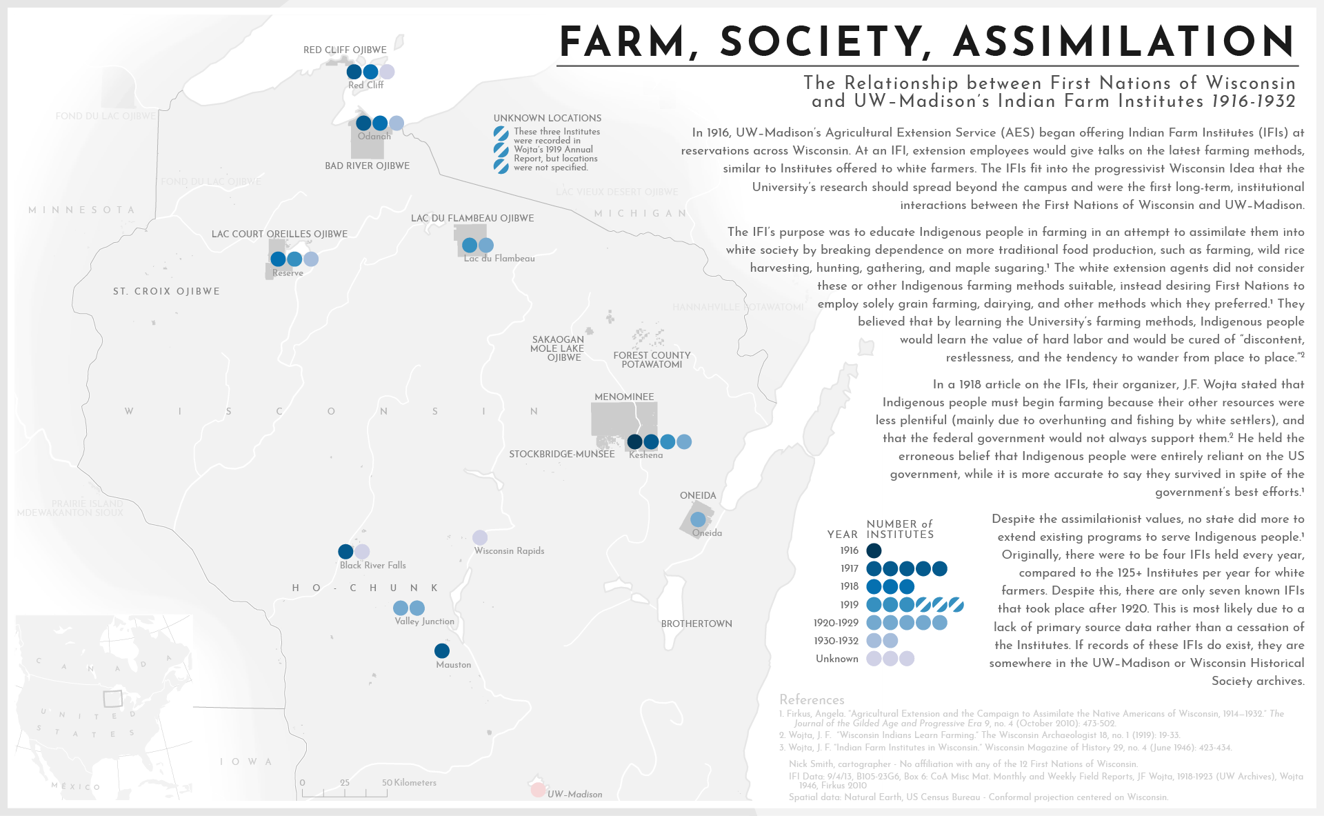
Farm, Society, Assimilation
#Map #Justice #Wisconsin
This map is intended to be a part of my history capstone paper on the same topic, that of the Indian Farm Institutes that were run by UW–Extension's predecessor and their ideological parallels with the Society of American Indians. The IFIs were, though not explicitly planned this way, a part of the larger assimilationist machine run by white socity for centuries. The bulk of the technicality of this map was figuring out how to represent the uncertainty in much of the data.
Bornholms Museum
#Logo #AlmostInTheWild
When I went to an archaology field school in summer 2019, I casually mentioned to my instructors that I do some freelance design sometimes, so they had me redesign the museum's logo in my end report. To the best of my knowledge, they haven't acted on it (and it could use some work yet), but I greatly enjoyed designing this. (Shoutout to everyone at Bornholms Museum for being awesome folks!)
ACS and CANES Dept. Stickers
#Sticker #Community #InTheWild
These stickers I made at work were an absolute treat to work on. The gorgon is by far my favorite, and all of these are be available from the ACS and CANES departments (if you know where to find them!)
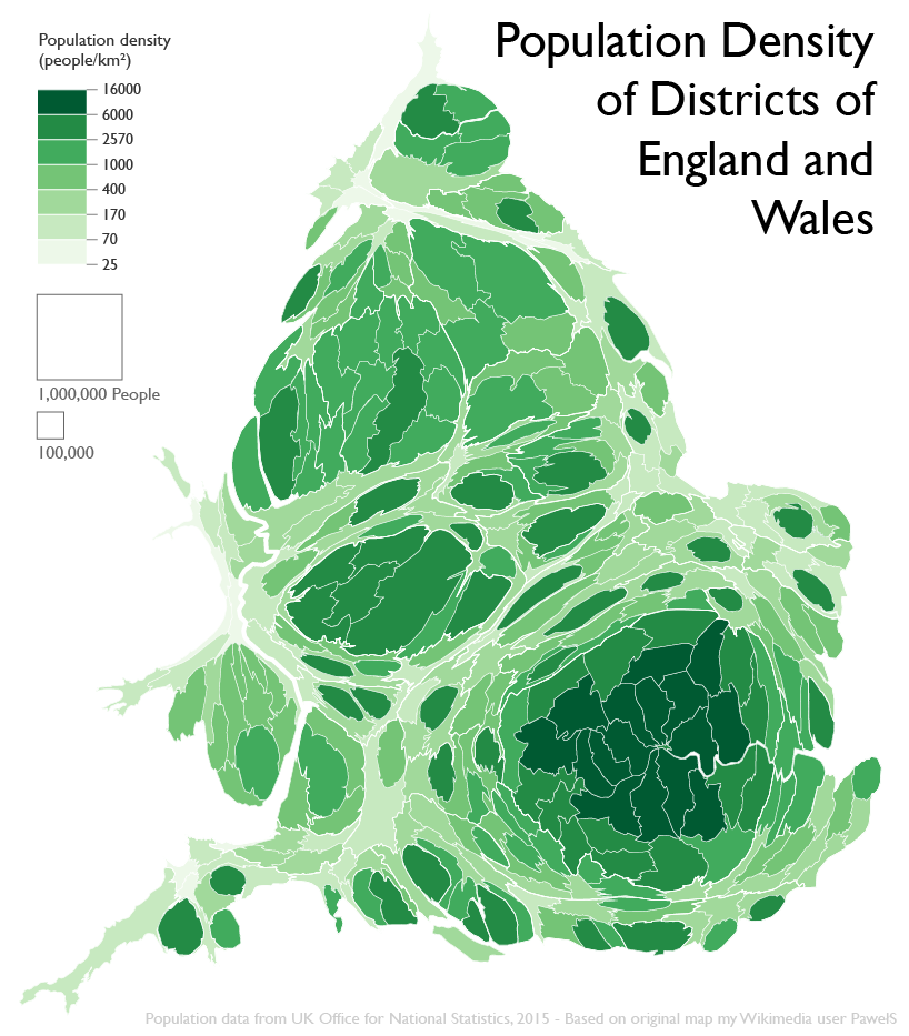
Population Density of Districts of England and Wales
#Map #FixWikiMaps
I made this map mostly out of spite and also as part of the Fix Wiki Maps Project—the original version on Wikipedia was rather rough, so I took it on myself to fix it at least a little bit, and here's the result.
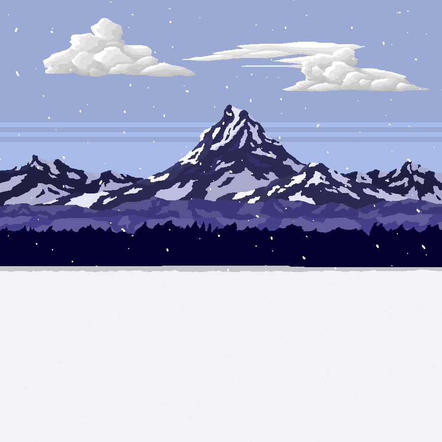
Montagne
#Gif #PixelArt
I made this gif for an animation project in an Intro to Digital Design class. While I had modicum of experience in graphic design for a couple years earlier, this class is what really got me into it! (Shoutout to my TA, Timothy Arment!)
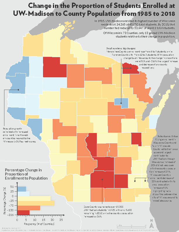
Change in the Proportion of Students Enrolled at UW–Madison to County Population from 1985 to 2018
#Map #Wisconsin
That was a mouthful. This map shows what areas of Wisconsin have seen a relative increase in students enrolled at UW–Madison, even with the loss of over 12,000 in-state students from 1985-2018.
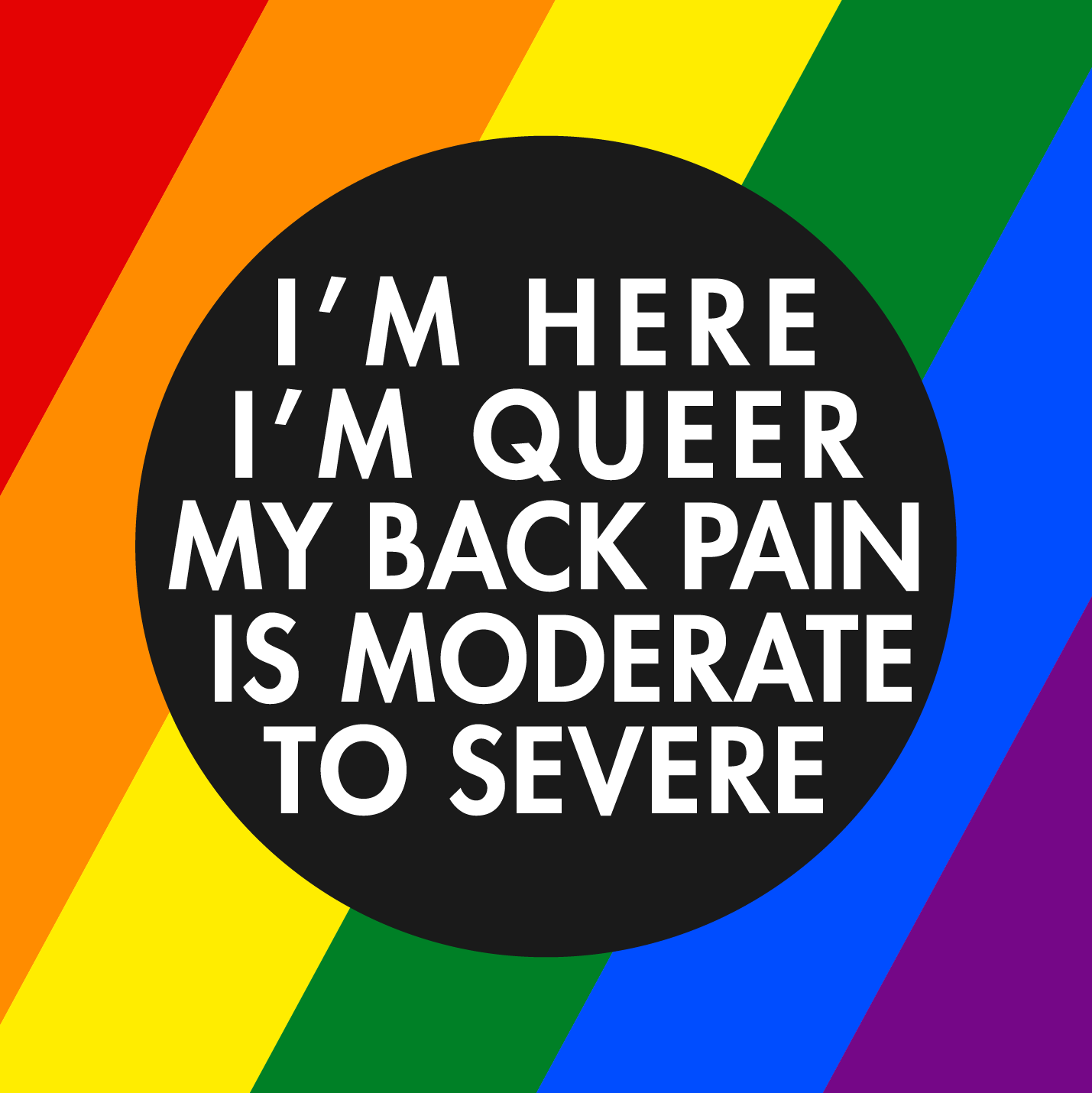
I'm here, I'm Queer, my back pain is moderate to severe
#Graphic #Queer #Community
My very good friend said this once and I never got it out of my head, so here we are.
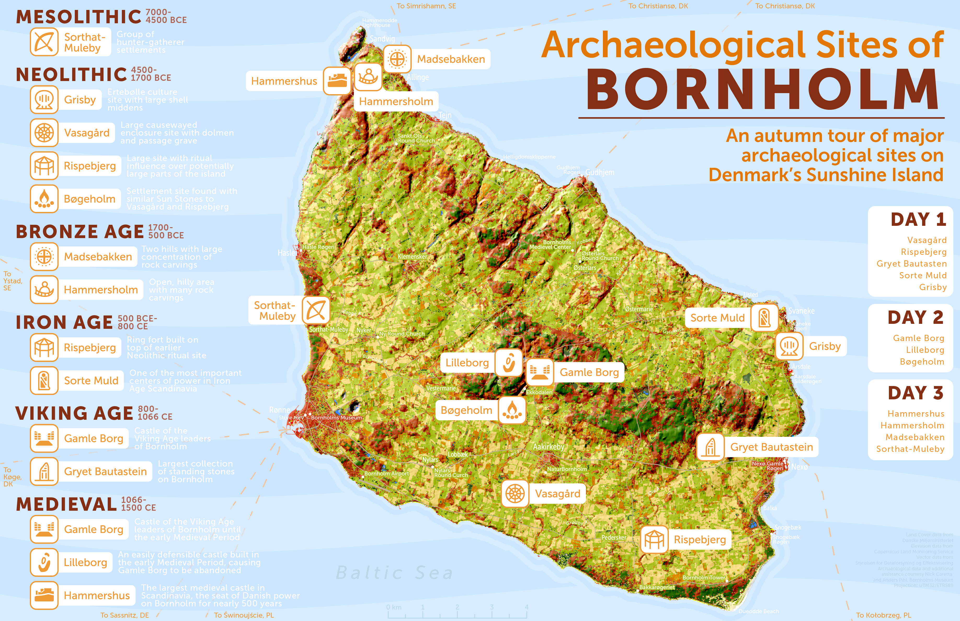
Archaeological Sites of Bornholm
#Map #UnderConstruction
This map was inspired by the archaeological field school I attended on Bornholm—some of my fondest memories were created there. This map in particular describes 3 perfect days on Bornholm. It is also under construction! I have to make an arduous trek into Photoshop to correct some contrast issues, make it more colorblind friendly, and make it seem less plasticky in general. Once I do, the original will be archived for view here to show the process.
AnthroCircle
#Logo #Community #InTheWild
The logo I created for AnthroCircle, UW–Madison's anthropology student organization. This logo used colors and took inspiration from the org's previous logo.
The Wassailing Pacific Community Calendar
#Graphic #NationStates #Community
I'm very pleased with the way this turned out—it's the community calendar for the winter celebrations, whose planning I led, of an online community I'm a member of.
Monarksriket Fujai
#Flag #NationStates
The flag of Monarksriket Fujai (the Monarchy of Fujai), an island country located far to the north of Polaris. Contrary to popular belief, this flag was not based on the Union Jack.
A New Look: Centralized, Dynamic Counties in Wisconsin
#Map #Wisconsin
I made this map in the summer of 2019, inspired by Claire Trainor's map and the subsequent New York Times article. Simply put, with only 5.8 million residents, Wisconsin doesn't need 72 separate counties. This map got my ideas on the matter out into the world.
Chemin de Fer
#Map #Web
Learning to make slippy maps in Mapbox was a time and a half, let me tell you. I wasn't entirely pleased with my Art Nouveau-inspired theme at first, but after receiving positive feedback, I'm rather proud of it. Click here to explore the map.

Hot Reads for Cold Nights
#Logo #Community #InTheWild
I made this logo for the La Crosse County Public Library's new winter 2019 reading program. It appears on promotional materials and merchandise.
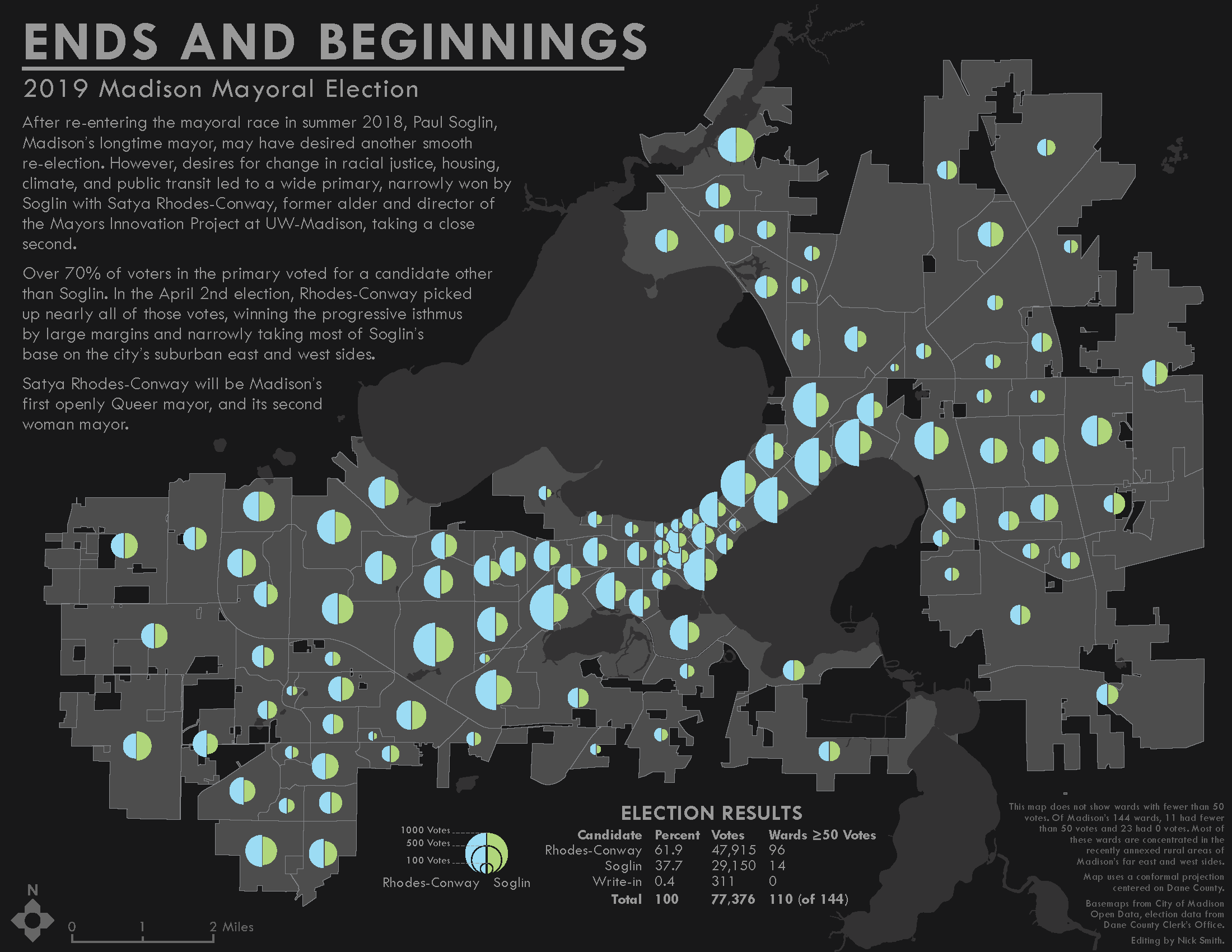
Ends and Beginnings: 2019 Madison Mayoral Election
#Map #Wisconsin #Community
In Intro to Cartography, the proportional symbol map was assigned just after our historic mayoral election, where the first out Queer woman was elected mayor of Madison. Naturally, I had to make a map about it.
Pencil » d20 » Adventure
#Graphic #Icons
This was the second project I did learning Illustrator, again in that Intro to Digital Design class. My TA complemented this a lot and for that motivation I'm thankful.
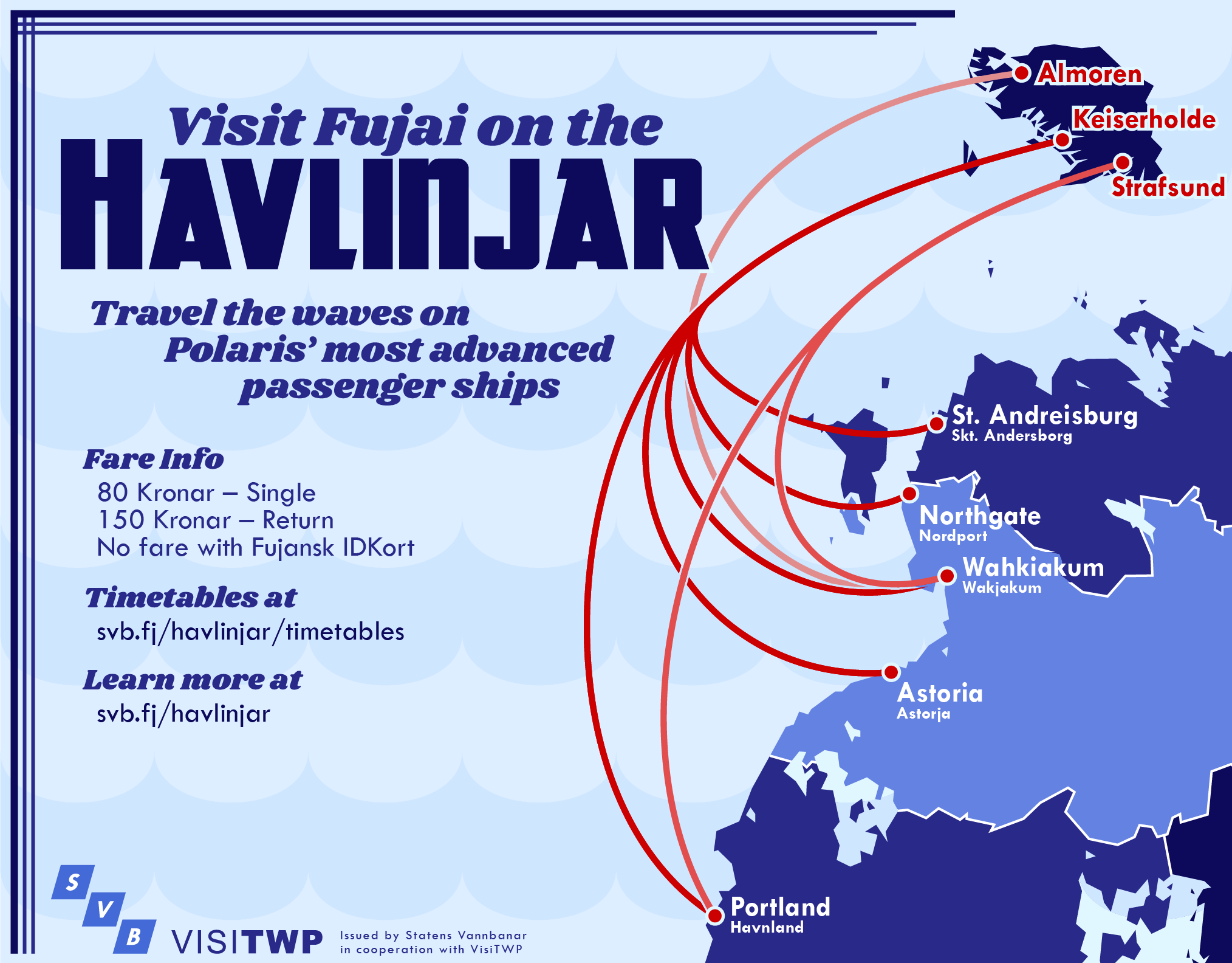
Visit Fujai on the Havlinjar!
#Map #Graphic #NationStates
I made this for the imaginary nation of Fujai, which specializes in high-speed, electric ferries instead of airplanes.
OCTWPUS
#Logo #NationStates #Community
Octopi are very hard to draw.
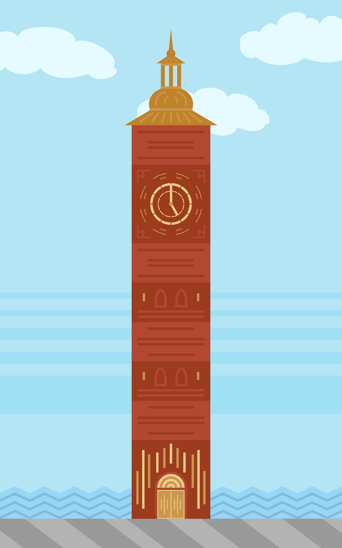
Rådhustårnet
#Graphic #NationStates
Back at it again with Rådhustårnet, the tower of Keiserholde's city hall. There's a whole building attached to it as well, but we'll get to that later. This was heavily inspired by Stockholms Stadshus, Oslo Rådhus, and the Pražský orloj (Prague Astronomical Clock).